
Sometimes a delay is worth it. I had planned a trip with some other members of my ski patrol, but due to the hideous weather a week ago, I rescheduled it. Since no one was available this week, I ended up going solo. I do solo day trips fairly frequently, but in recent times I have found it easy to stick to familiar routes and out of big-mountain environments. But this time – with a lot of warm weather followed by cooler temps stabilizing the snowpack at moderate elevations – I decided to be a little more ambitious and do an overnight into the Teanaway backcountry on the East slopes of the Cascades.
The Teanaway area is one of my favorite backcountry destinations anywhere. I have been to several peaks there, mostly as car-camping based day-trips. One area I had never been was the Stafford Creek trail to Navaho Peak (elev. 7,223′). Navaho is not a terribly photogenic peak; it is a broad, mostly forested, lumbering sort of mountain, but it is a little more remote than neighboring Earl Peak, which I had visited before and is a very popular destination. On paper and on Google Earth it looked like a good candidate for moderate skiing and manageable hazards, an important part of going solo on snow.
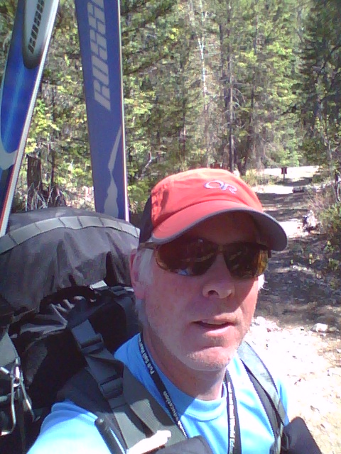
I drove over the Cascades, and after a brief delay when I remembered I needed a new annual Forest Pass – and found the Cle Elum ranger station closed for lunch – I weaved my car around the potholes and ruts of FS Rd 9703 to the Stafford Creek trailhead (3,000ft) and hit the trail a little after 3pm on Friday (May 16, 2014).
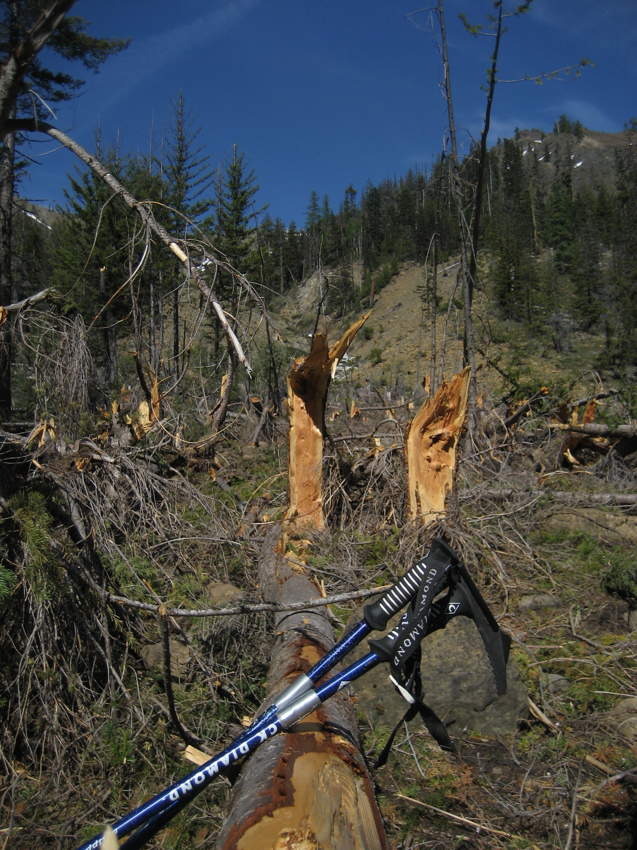
It was bright, sunny, and hot in the afternoon sun on the western exposure of the trail. In one 10-yard stretch I saw at least 3 different butterflies, white Trillium in the wetlands, and yellow Avalanche Lillies just beginning to bloom. The trail also crosses a couple of very impressive avalanche debris fields.

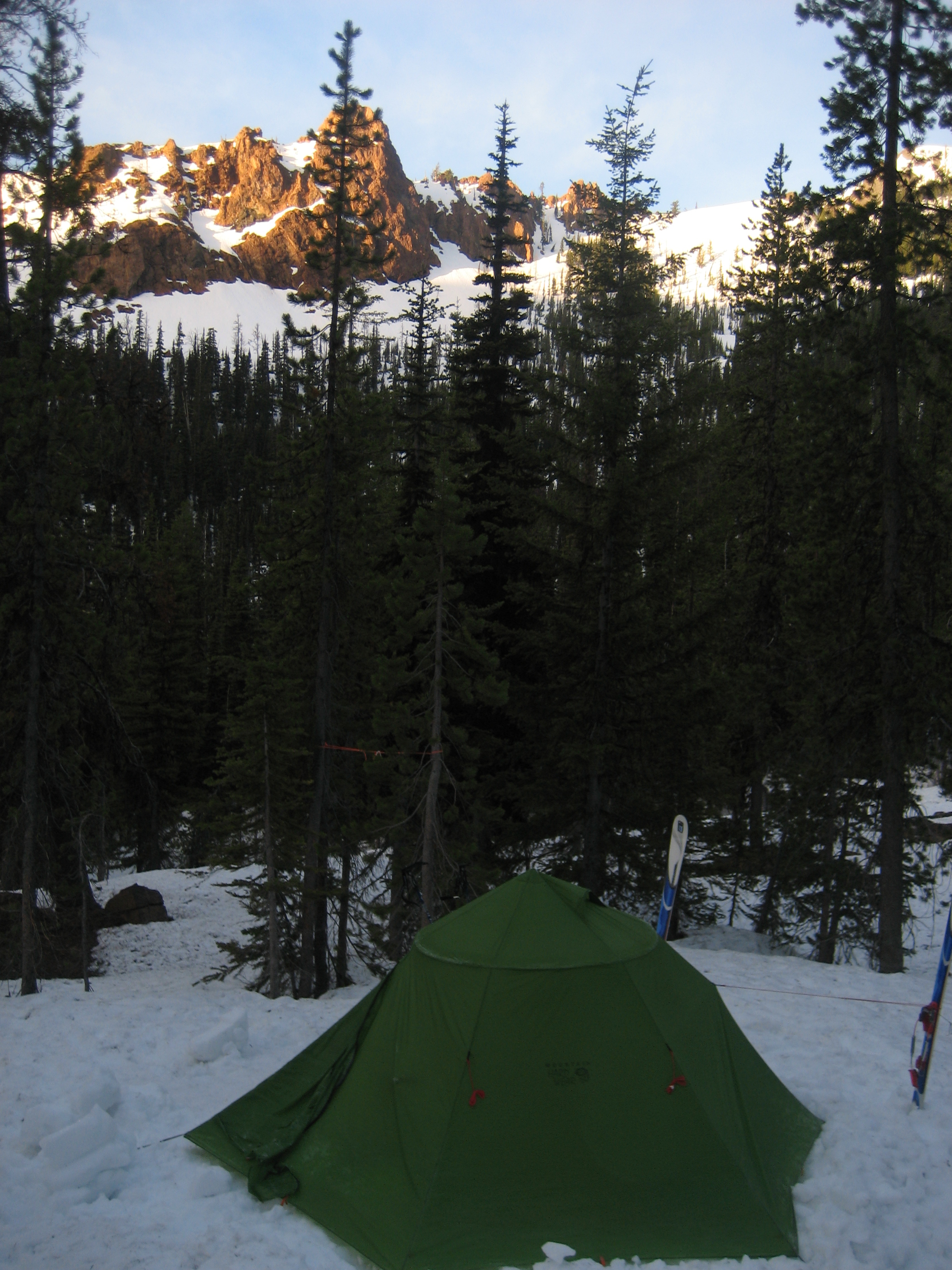
The trail was snow-free to about 4,000′, and then was discontinuous snow, so I ended carrying my skis all the way until I located a good camping spot at about 5,000′ (ugh!).
Overnight was clear and cold, with a bright, barely waning moon which made sleep difficult. I left camp under clear, sunny skies at 6:45 in the morning.
The cold temperatures overnight made the snow very firm and the skinning was perfect. After shedding layers a couple times going up through the trees, I got higher in the basin between Earl and Navaho Peaks and the views opened up, but the clouds also started to creep in. In the open the breeze made it quite chilly, so I put layers back on again. This was to become a recurring theme throughout the day.

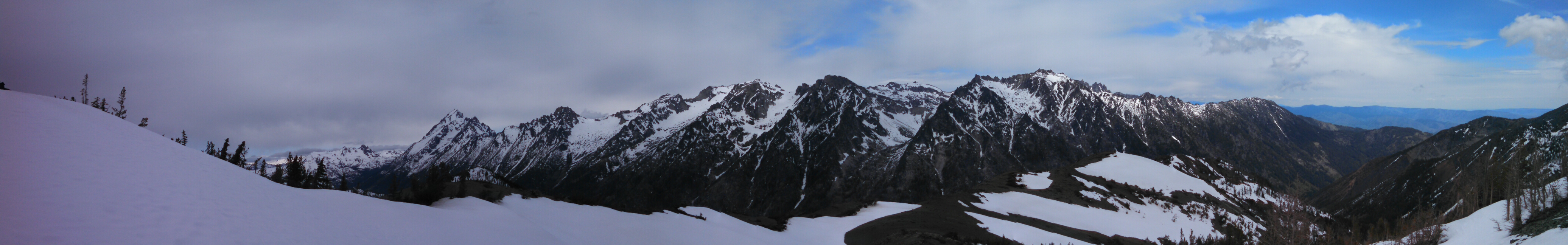
I gained the saddle at 6050′ on the ridge between point 6658 and Navaho. One of the beauties of traveling in this area is that many of the ridges are sharp and the valleys are deep, so you are often greeted with with sudden, dramatic views, and the Stuart Range is among the more dramatic anywhere.
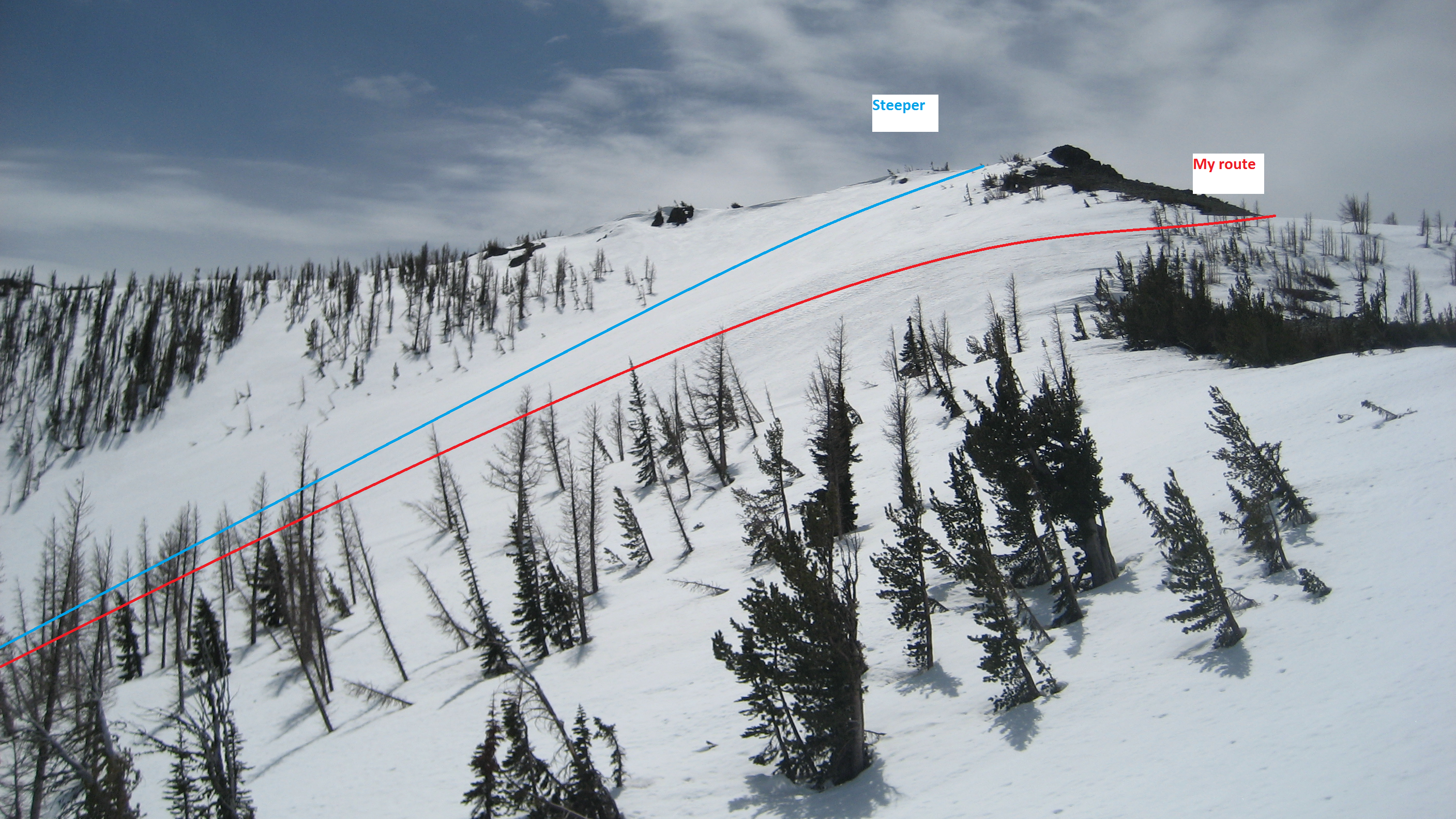
I encountered two other hikers who, in spite of the 7 cars at the trailhead when I left and the other tracks in the basin, were the only other people I met on Navaho. The main ridge up to the summit was completely devoid of snow, so I stayed to the NW side of the main ridge and ascended a wide, heavily treed SW-facing gully where I found some old snow machine tracks!? To stay on snow as high as possible, I circled to the NW to about 50′ below the summit rock pile, where I ditched the skis and scrambled up to tag the summit, joining the hikers who had beaten me up the ridge.


From the summit I scoped out my descent options. I could retrace my steps and get a fine ski back to camp, or there is a spectacular basin running NE from just below the summit. You can drop in from just E of the summit, or you can take a gentler run to the N then turn E down the same drainage.
Up to this point the weather had been changeable, but mostly cold, overcast, and breezy, so things were still pretty firm at 11am. I decided to wait in the shelter of some rocks where I left my skis to have a snack, and wait for conditions to soften up a little more. From both an avalanche and a skiing standpoint this is nearly ideal. You get solid, stable snow underneath, and a soft surface of corn snow perfect for turns. While I was waiting, the sun reappeared and it warmed up markedly, so I decided to get going before it got too soft. With the summit launch’s steeper pitch, firm show, and the fact I was solo, I decided to play it safe and ski 200′ down the gentler shoulder to the N then turn about 800′ down the same drainage. It turned out to be a perfectly enjoyable 30-40 degree descent in the best spring conditions I have skied in years! True hero snow!

Of course, in the backcountry whatever you ski down you have to skin back up, so I slogged back up to the 7000′ shoulder, reaching it at about 12:15. Meanwhile, it clouded up again, I took one more panorama of the Stuart Range, then headed down. I more-or-less retraced my route back to camp in warm, sunny conditions.
 The ski down was still in great shape until about 5600′ where things started getting pretty wet and sloppy. I had to take my skis off at about 5200′ because things were melting out so fast. I packed up camp and headed back to the car, which in the very soft, discontinuous snow to 4000′ was kind of a death march.
It has been quite a while since I pushed myself that hard, with a day of 3,000+ ft of ascending and 5,000+ ft of descending, especially solo. A trip with my patrol partners would have likely been no less fun or challenging, but exploring a new place at my own pace – without the influence of others’ experience, opinions, and agendas – forced me to rely exclusively on my own judgement, reconnected me to my own own rhythms, and reconnected me with many reasons why I do this in the first place.
Route map as tracked by my GPS for May 17 is here: http://caltopo.com/map?id=574M

Wow! Your trip was really worth it. You also had great pics. For sure, your friends didn’t realized what they missed. 😀 Great job! ^_^